 |
 |
 |
 |
Rio Simon 

Presentazione:
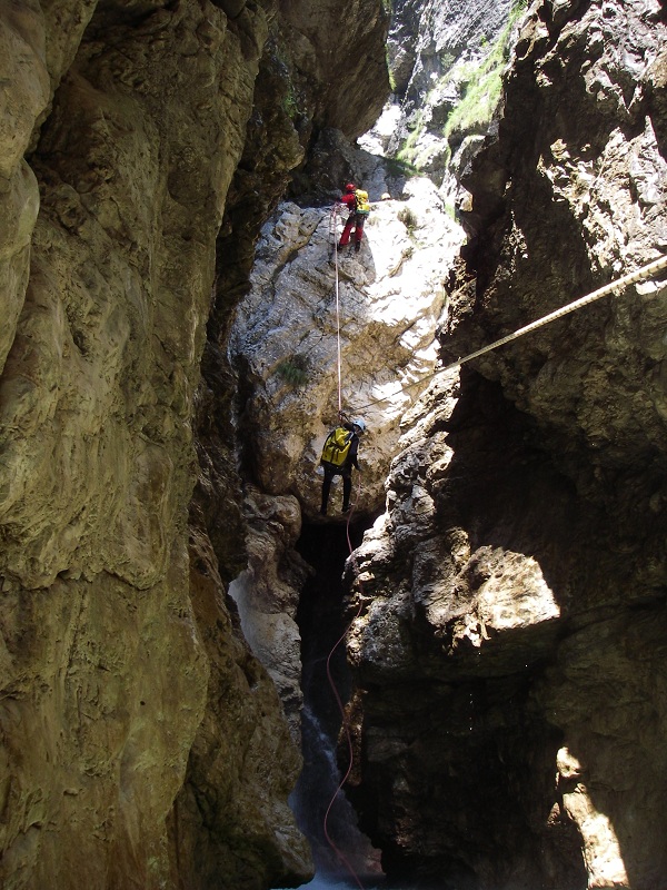
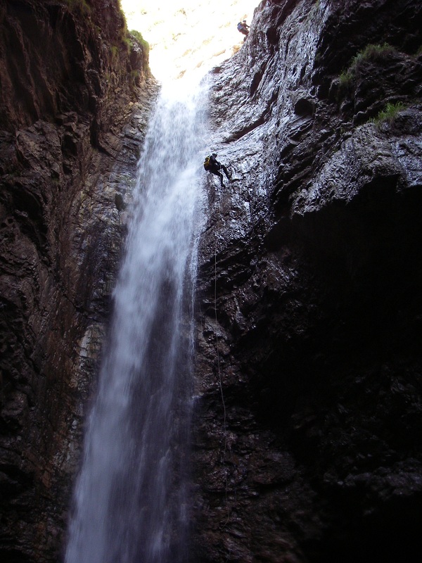
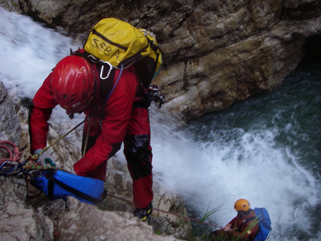
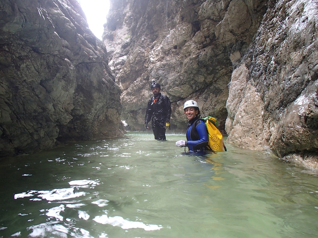
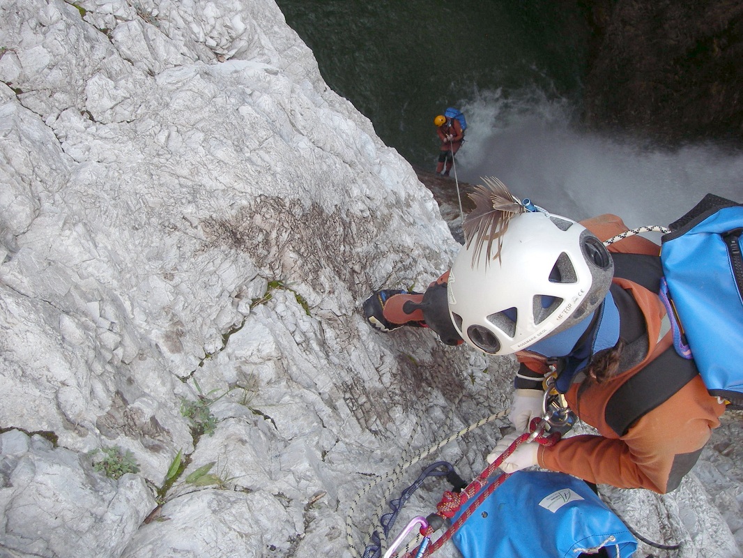
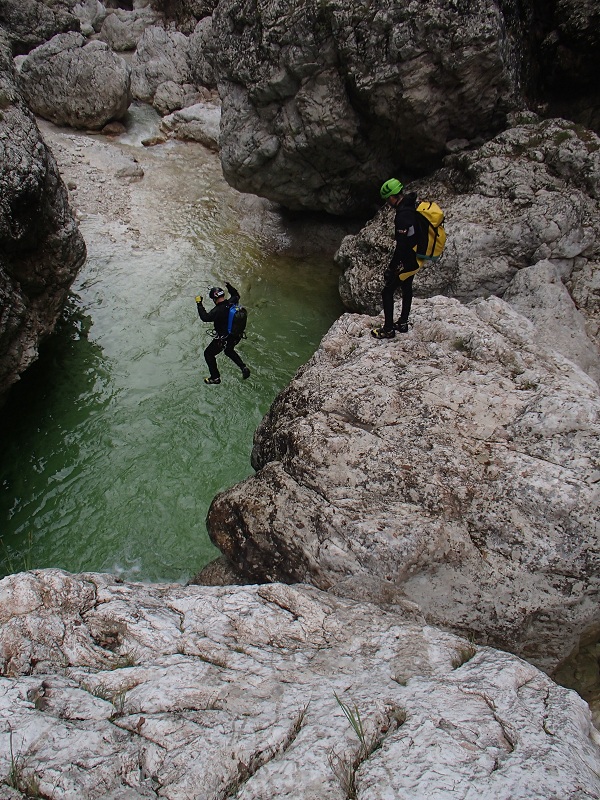
This is probably one of the most beautiful canyons around the Friuli Venezia Giulia region. The environment is immense and impressive, while the route is fun and
varied. The first section is more discontinuous (9 pitches) and the second (lower) section is very aquatic and continuous, characterized by the possibility of
making different jumps.
Zone:
Friuli Venezia Giulia - Chiusaforte (UD)Elevation and length:
Entrance: 900 mExit: 340 m
Height difference: 560 m
Length: 4000 m
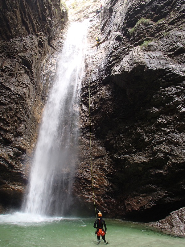
Highest pitch: 35 m
Advised decent period:
From June to SeptemberExposure:
SouthTimings:
Approach: 2h 15 mins (1h 15 mins for the lower section only)Descente: 5/6h (3h for the lower section only)
Return: 5 mins
Shuttle:
1 KmAnchors:
Good (upper section) / Excellent ProCanyon (lower section)Advised ropes:
2 of 50 m + emergency ropeGear:
Full wetsuitEscapes:
It is possible to escape approximately halfway down the canyon using the access trail to the lower section. This path is barely visible and branches off in a large
area with red rock slabs to exit the canyon on the right bank. Following the path, you will reach Roveredo in approximately an hour. Alternatively, in the section,
before the 35 m pitch, on the left bank there is a path marked with red signs that leads to an exit.Map:
Carta Tabacco 1:25000 foglio n° 018 - Alpi Carniche Orientali Canal del FerroInterest:
NationalDifficulty:
V4 a4 VCoordinates (WGS84) for downstream (valley) parking and canyon exit:
46° 23' 54.6''N 13° 15' 46.56''ECoordinates (WGS84) for upstream (mountain) parking:
46° 23' 49.38''N 13° 15' 8.94''ECoordinates (WGS84) of the start of path CAI n° 424:
46° 23' 55.98''N 13° 14' 47.34''ECoordinates (WGS84) for leaving path CAI n° 424 and deviation for lower section access:
46° 24' 25.5''N 13° 15' 13.44''ECoordinates (WGS84)of the escape route / lower section starting point:
46° 24' 50.82''N 13° 15' 43.02''ECoordinates (WGS84) of the riverbed access point (start of canyon):
46° 23' 40.56''N 13° 15' 27.12''EApproach to the valley (lower car park):
Follow the SS13 towards Tarvisio. Continue through the town of Resiutta and, shortly after, pass through a tunnel. Just after this tunnel, turn left at the
junction towards Roveredo, cross over the Rio Cuestis, and quickly you reach the bridge over the Rio Simon (canyon exit). Park here in the large space on the left.Approach to the mountain (upper car park):
Continue with the shuttle car for about 1 km towards Roveredo and park in the large space near to the fountain on the right.Approach to the canyon (walking):
From Roveredo, take the path CAI n° 424 (the start of the path is not precisely identified but is found in front of the penultimate house, n° 107). Continue along
a grassy ramp, to reach the ProCanyon (white/blue) marked trail.Follow this path, which may be initially covered with vegetation, and after about 15 minutes cross the Rio Brezzi and then continue climbing along the right bank of the Rio Simon valley.
After about 40 minutes, you reach a crossroads with the path n° 520 on the left, near some iron crosses, continue straight along the path n° 424. Further on, the path crosses a stream that is often dry or with very little flow. Here, there are evident ProCanyon sings that mark the trail to the intermediate access (lower canyon section).
To reach the upper section, which is still a long walk further on, continue along the CAI path n° 424 (white/red markings). This path crosses a tributary, then a meadow with a small hut, and then a second tributary. There are a number of other deviations from the path, but the correct route is well marked. The access to the riverbed is found in the area where the path approaches the river.
Description and technical notes:
01 - P 12 L02 - MC NA + P 16 L
03 - MC + P 10 R
Continue for about 200 m
04 - P 11 L (sloping)
Attention: do not descend in the current but keep left (orographic), climb up the flat rock and, hidden behind the corner, is the next bolt.
05 - P 25 L
Continue for about 400 m
06 - J 5
07 - P 20 L (06 and 07 are by-passable on the right)
Continue for about 200 m
08 - P 6 L (by-passable on the left)
09 - J 3
Escape route. Continue for about 50 m, keeping right.
10 - P 13 R
11 - MC + P 8 R
12 - MC + P 15 L
13 - P 2 R
Short meandering passage
14 - J 4 (by-passable)
15 - MC + P 6 L
16 - MC + RB + P 12 L
17 - MC + RB + P 10 L
Meandering passage of about 200 m
18 - MC + RB + P 6 L
19 - P 10 R / J 7
20 - MC + P 22 central
Attention: Climb up the large rock in the centre and not towards the old spit on the right that is after the flat, exposed and slippery rock. There are two cemented bolts at the base of the pitch for a Tyrolienne.
21 - MC + P 7 Dx / J 7
22 - J 2 / D L
23 - P 2 L
Landslide
24 - P 8 R
25 - MC + P 33 L
There are two cemented bolts at the base of the pitch for a Tyrolienne. Pay attention to the return current under the large waterfall.
26 - P 3 R / J 2
27 - P 4 L / J 4
28 - MC + P 6 R / J 6
29 - D 15
Exit:
After 10 minutes walking in the riverbed you reach the bridge where the car is parked. Alternatively, in an additional 10 minutes you will reach the village of Roveredo.Notes:
The first descent was made in August 1993 by Kaiser A., Lombardi A. and Taverniti M.URL:http://www.canyoneast.it
Layout, design & revisions © 2017, CanyonEast Canyoning Team - Seba Broili, Vanessa Johnston, Romy Siegl, Cristian Vogrig
Webmaster: uomonero@canyoneast.it - Revised - - 22/08/2017
Layout, design & revisions © 2017, CanyonEast Canyoning Team - Seba Broili, Vanessa Johnston, Romy Siegl, Cristian Vogrig
Webmaster: uomonero@canyoneast.it - Revised - - 22/08/2017


